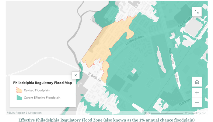
FEMA has recently produced an updated floodplain map of the Eastwick section of Philadelphia. As one of the lowest lying neighborhoods in the city, Eastwick has been at the forefront of a variety of major flooding events over the years, including Hurricane Floyd in 1999, and more recently Tropical Storm Isais in 2020. The major update in this map is that more residents will have information about their “base flood elevation”, or the estimated depth of flooding in a 1% chance flood event. This information can help residents decide how high to elevate their utilities or more important items on the ground floor to prevent damage in a flood.
FEMA has also developed an interactive story map to observe these new mapping changes. The changes are expected to go into effect Summer 2023.
OOS will be letting residents in Eastwick know about these changes through letters in the mail and door-to-door outreach as part of ongoing efforts to improve communication and transparency between Eastwick residents and governmental partners.