In a substantial release of open data by the City of Philadelphia’s Department of Licenses & Inspections (L+I), 11 datasets are now available at OpenDataPhilly.org, with interactive charts and maps accompanying each.
The visualizations enable users to easily browse, sort, and drill down into the data within their web browser. The multiple formats within the datasets make them more readily useable for members of the public who do not have specialized technical skills as well as for programmers and technologists. The datasets are also available for bulk download.
L+I led the way for open data in 2012 with a sizable release of datasets. Today’s release includes improvements on 5 previously-released datasets as well as 6 new datasets which will be updated automatically on a daily basis.
The data shows permit and license issuances as well as code enforcement activity of the department. Three city agencies worked in partnership to prepare and release these datasets, including L+I, the Office of Innovation and Technology’s (OIT) GIS Services Group (GSG), and the Office of Open Data and Digital Transformation (ODDT).
Released Data at a Glance
Dataset names italicized below indicate an improvement on a previously released dataset, all others are newly released.
Data pertaining to permit and license issuance include:
- Building Permits: download, see visualization or read the metadata
- Business Licenses: download, see visualization or read the metadata. A spatial version of this data will be released in the future.
- Trade Licenses: download, see visualization or read the metadata
- Commercial Activity Licenses: download, see visualization or read the metadata.
Data pertaining to code enforcement activity of the department include:
- Service Requests: download, see visualization or read the metadata
- Clean & Seals: download, see visualization or read the metadata
- Inspections: download, see visualization or read the metadata
- Code Violations: download, see visualization or read the metadata
- “Unsafe” Violations: download, see visualization or read the metadata
- “Imminently Dangerous” Violations: download, see visualization or read the metadata
- Appeals of Code Violations and Permit Refusals: download, see visualization or read the metadata
Engaging the Tech Community
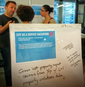
L+I released these datasets in time for civic technologists to use at last weekend’s City as a Service Hackathon (CaaSH), organized by Code for Philly. Tech staff from L+I joined the developers at CaaSH to answer any questions about the datasets and help think about potential projects. The Chief of Staff for Mayor Kenney, Jane Slusser, delivered the keynote speech at event, and Chief Data Officer Tim Wisniewski and L+I Director of Planning Rebecca Swanson were also in attendance.

The hackathon, which aimed to improve basic city services and operations, kicked off a month-long sprint on Friday, September 23 with attendees brainstorming possible projects and initial designs over the weekend. Teams will have a month to work on the development of their projects, aiming to create work that will have an impact on communities. Demonstrations of completed projects will take place on October 25, 2016.
The data release and hackathon participation are part of a broader effort at L+I to leverage data to better protect public safety. Currently, for example, L+I is partnering with OIT/GSG and ODDT on the development of advanced models that are improving how inspectors identify vacant and imminently dangerous properties. By engaging with the tech community, L+I hopes to inspire efforts that will lead to further improvements in how the City uses data.
Making Data Easier to Use
When L+I released datasets in 2012, it did so through an API, which allows programmers to create applications and other tools. At the time, L+I also built a searchable application on their website for some of the data and worked with OIT’s GIS Services Group to create maps on the City’s maps site. The latest release improved access to these datasets by enabling bulk download of each dataset, providing the data in multiple formats, and supplying easy-to-use tools for the creation of interactive visualizations. Equipped with these tools, residents can easily browse open violations in their neighborhood and see related enforcement activity, or download a list of businesses of a particular category.
L+I hopes that sharing information in this way will inform and empower residents seeking to understand and affect conditions in their neighborhoods and throughout the City. The following examples are only a few of the possibilities; there are many others, no doubt including many that will be originated by the users themselves over time.
- Residents organizing to address blight can easily find all of the relevant data on vacant properties they are concerned about in their neighborhoods. This includes the identity of the owners, property maintenance code violations, how many services requests have been filed, the last time L+I inspected the property, and whether the property is characterized as “imminently dangerous” or “unsafe.”
- Potential small-business owners can get a clearer picture of promising places to locate their businesses by working with business licenses and Commercial Activity Licenses data.
- Homeowners can access information to help them better care for their own properties and protect themselves from unscrupulous contractors. They can look at trade license data to ensure that they hire licensed contractors, and review permits the contractors have been issued to learn more about the projects they’ve completed in the past.
Keep in Touch!
There’s lots of ways to get involved. For information about City datasets and others, go to OpenDataPhilly.org. Visit this resources page for video tutorials and links to tools to help analyze data. Follow @PHLInnovation on Twitter to get alerts on future data releases, share how you plan to use open data with data@phila.gov, and join us on the public open data google forum. To participate in future hackathons or stay informed about projects from the CaaSH event, connect with CodeforPhilly.org.