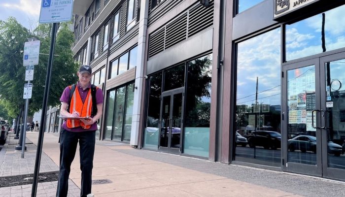
City planners from the Philadelphia City Planning Commission are traveling throughout Philadelphia’s neighborhoods to conduct a land use survey.
City planners work in pairs as they compare the City’s property records against the real-life activity in neighborhoods. The information gathered in a land use survey includes things like:
- Whether or not there is a building on site,
- the number of stories in the building,
- whether a building has a commercial, industrial or residential use, and
- how many residences may be in the building.
They do not record information about ownership, building condition, vacancy, or permits. This survey is an information-gathering exercise; it is not for enforcement purposes.
Planners use this information to update the City’s records so that City staff, including those in other agencies, like the Department of Commerce or the Streets Department, can make data-informed recommendations and decisions.
You can see the current land use survey information on OpenMaps by selecting the “Land Use” layer.
The last time city planners conducted a city-wide land use survey was between 2011 and 2018, as part of the Philadelphia2035 comprehensive plan. This year’s land use survey work will help inform Philadelphia2050, the City’s comprehensive plan update.
Almost every municipality conducts land use surveys, and some do it every year. Philadelphia has a large number of very old buildings with a variety of uses, and an annual comprehensive survey is not possible for our staff.