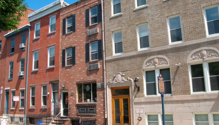
Have you ever wondered exactly where your property lines are? Or searched for your home on atlas.phila.gov to see your lot boundaries? Behind every accurate property map in Philadelphia, there’s a team of dedicated workers you’ve probably never heard of – the Mapping Unit at the Department of Records.
What do they actually do?
Think of the Mapping Unit as property detectives. Every time someone buys or sells property in Philadelphia, a deed gets recorded at City Hall. But here’s what most people don’t know: after that deed is filed, a team of expert mappers reviews every single legal description to make sure it matches the city’s official digital maps.
Why does this matter? Imagine if the deed to your house said you owned a 50-foot-wide lot, but the city’s maps showed it as 40 feet wide. That 10-foot difference could affect your property taxes, cause problems when you try to sell, or create boundary disputes with neighbors.
Catching errors before they become problems
When the mapping team finds a mistake, they don’t just ignore it. They send out a “Deed Discrepancy Notice” to the property owner, suggesting they file a “Deed of Correction” to fix the error. They also make a note in the public database so everyone knows about the issue.
This might seem like a small detail, but it’s actually huge. These corrections help prevent costly legal battles, ensure fair property taxes, and keep Philadelphia’s property records accurate for everyone.
More than just error-checking
The Mapping Unit does much more than find mistakes. They’re the ones who update the city’s official maps when:
- Large properties get split into smaller lots
- Multiple properties get combined into one bigger property
- New condominiums or planned communities are built
Without this work, our property maps would quickly become outdated and useless.
Why this matters to you
These accurate maps power many services Philadelphians use every day:
- Property tax assessments – Making sure you pay the right amount, not too much or too little
- Atlas | phila.gov – The city’s website where you can look up any property’s boundaries and information
- Property disputes – Helping resolve arguments between neighbors about fence lines and boundaries
- Real estate transactions – Supporting buyers, sellers, lenders, and title insurance companies
- Utility services – Ensuring you get your water, gas, and electric bills at the right address
Supporting major city projects
The Mapping Unit also works on big, complex projects that benefit all of Philadelphia. They’ve helped with the H.O.M.E. Initiative, boundary work for The Rail Park (the elevated park built on old railway lines) and sports stadiums. These major projects require incredibly detailed and accurate property mapping to succeed.
Need help? They’re here for you
Here’s something many Philadelphians don’t know: the Mapping Unit is open to help the public with property research. Whether you’re trying to understand your property boundaries or need information about a street’s layout, they’re available to assist.
Here’s how to get help:
- For street boundary information, you can use the city’s Streets Legal Card Application
- Get property plats (detailed maps) at City Hall, Room 168
- Check the fees for property records before you visit
- Contact the Records Mapping Unit directly at mapping.info@phila.gov or (215) 686-1487
The bottom line
The next time you look up your property on Atlas or feel confident about where your yard ends and your neighbor’s begins, remember the Mapping Unit. These behind-the-scenes heroes work every day to keep Philadelphia’s property records accurate, fair, and useful for everyone.
Their careful, detailed work might not make headlines, but it helps our city’s economy run smoothly and gives property owners the accurate information they need. In a city where property ownership is often people’s biggest investment, that’s pretty important work.